
Charted as an 8 mile route east of Fort Dodge, the route connected coal mines in the area.
By 1885, it was made a standard gauge, and began consolidated operations with the Webster City and Southwestern Railroad, which operated from the existing route to Webster City.
In 1892, the CCR purchased the WC&SW. In 1893, the route would be extended to Fraser by the Boone Valley Coal and Railway Company.
Another railroad was formed in 1899, the Marshalltown and Dakota Railway, which planned to build from Marshalltown to South Dakota.
However, this route was never built. Despite this, the M&D completed a line from Fraser to Gowrie.
In 1901, the M&D name changed to the Boone, Rockwell City and Northwestern Railway. By 1904, routes would be opened to Newton from Fraser.
At the same time, the route to Rockwell City would also be completed.
In 1906, the Fort Dodge, Des Moines & Southern Railroad is incorporated to consolidate the numerous lines in the area. This route would become the largest interurban route in Iowa.
The railroad began to falter in 1930, and passenger service was reduced during World War II. Between 1968 and 1983, the route became part of the Chicago & North Western and several miles were abandoned.
In 1983, the Boone and Scenic Valley Railroad would be started to begin operations on a several mile segment of track from Fraser to Boone, along the Des Moines River.
Since conception, the B&SV has grown considerably and has become one of the main attractions in Iowa.
12/23/21
View an article regarding the construction of this bridge.
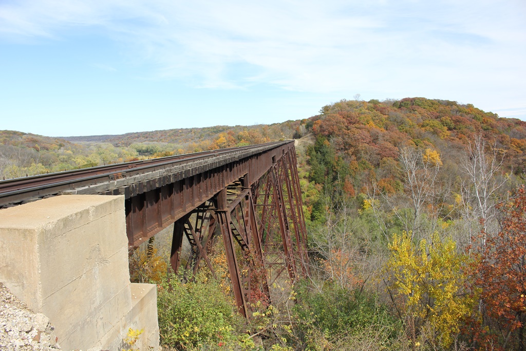
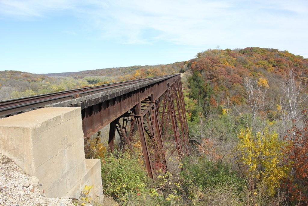
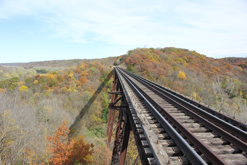
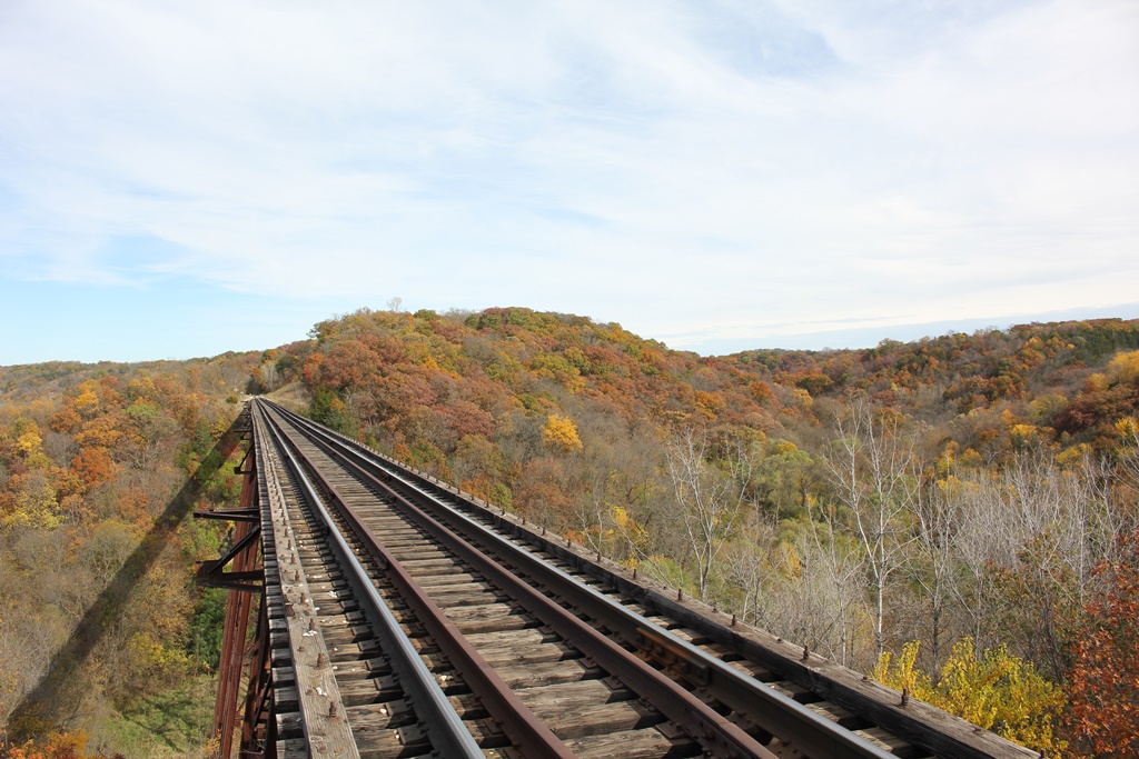
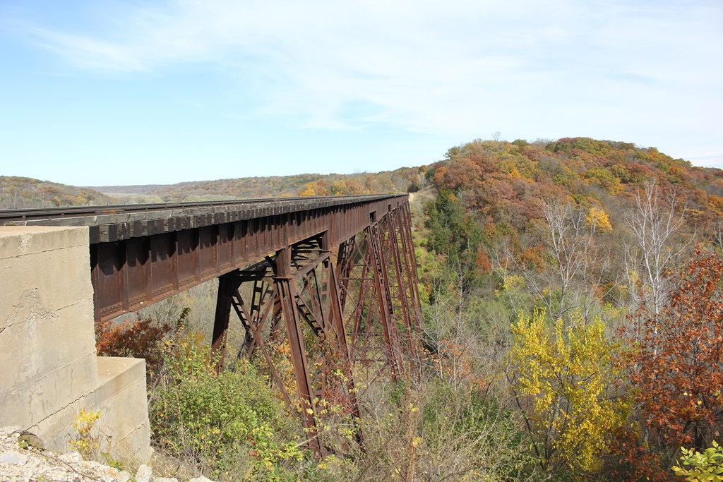
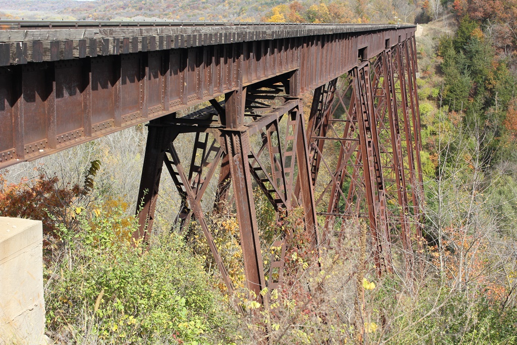
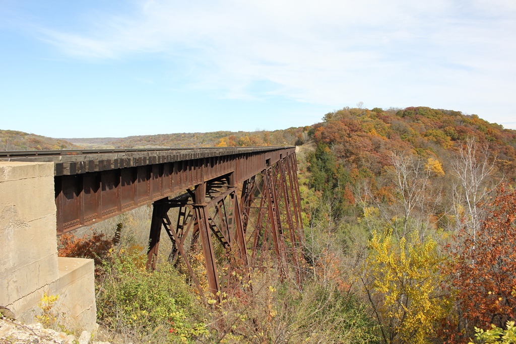
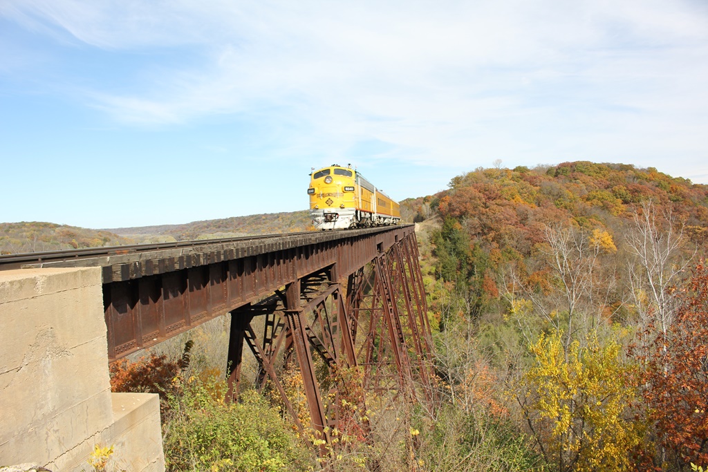
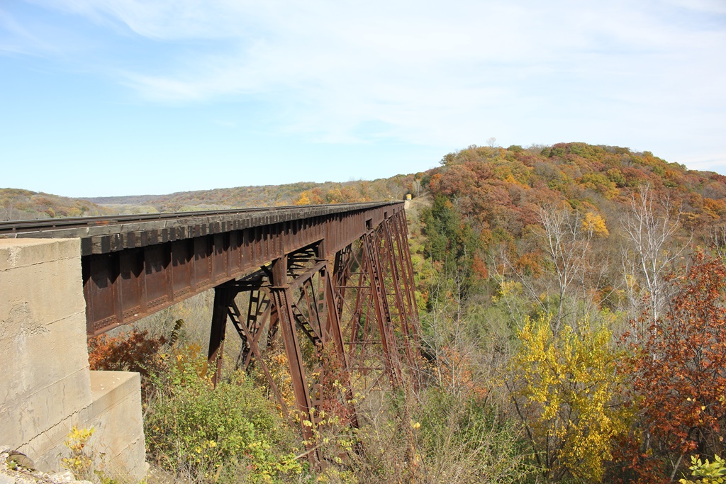
Located across a large valley north of Boone, this bridge crosses high above Bass Point Creek.
Built in 1913 to replace a failing wooden trestle, this bridge is extremely well known around central Iowa, due to the tourist trains which run over it, although it is not as big as the Kate Shelley High Bridge or the New Kate Shelley High Bridge.
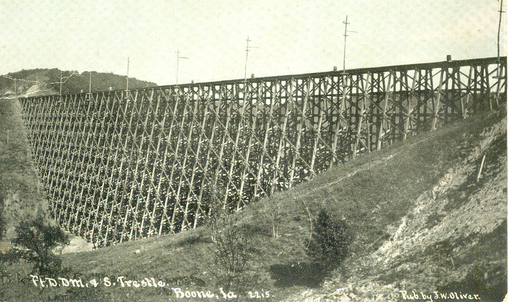
Historic photo of the previous bridge. Credit of PhotoLibrarian on Flickr, used with Creative Commons permission.
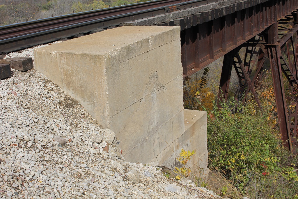
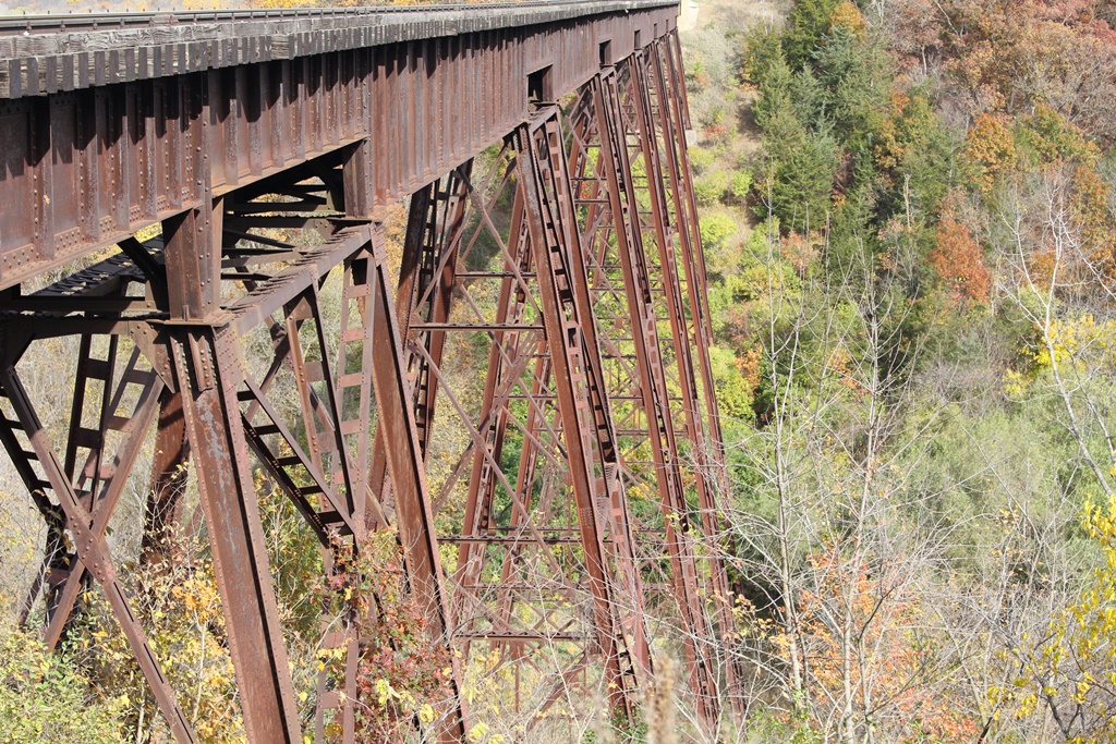
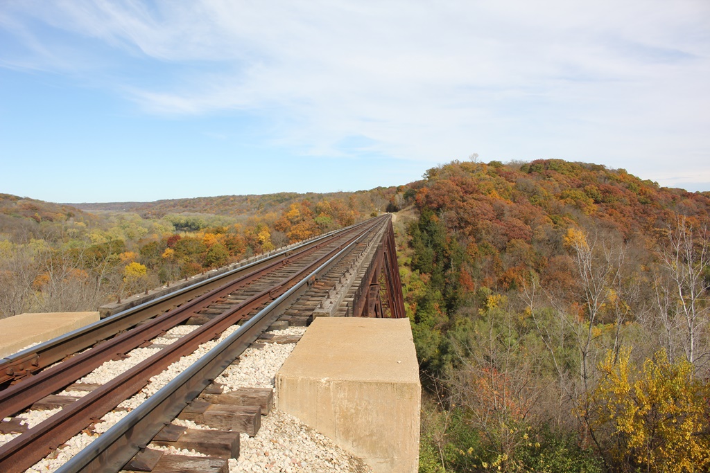
The bridge consists of 15 main spans, set onto steel towers and concrete bases. Sitting 157 feet above the creek, it is also nearly 800 feet in length.
Fortunately, the bridge is fairly open to public view. The Boone & Scenic Valley Railroad runs over the bridge, and this is one of the highlight locations. To access the bridge by foot requires water access or special permission.
As such a landmark structure, an excellent article was prepared regarding the construction of the bridge. That article can be seen here.
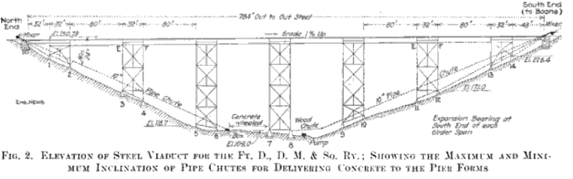
Scan of the blueprints, from Engineering News, Volume 69
The author has ranked this bridge as being moderately significant, due to the large scale size.
The photo above is an overview of the bridge.